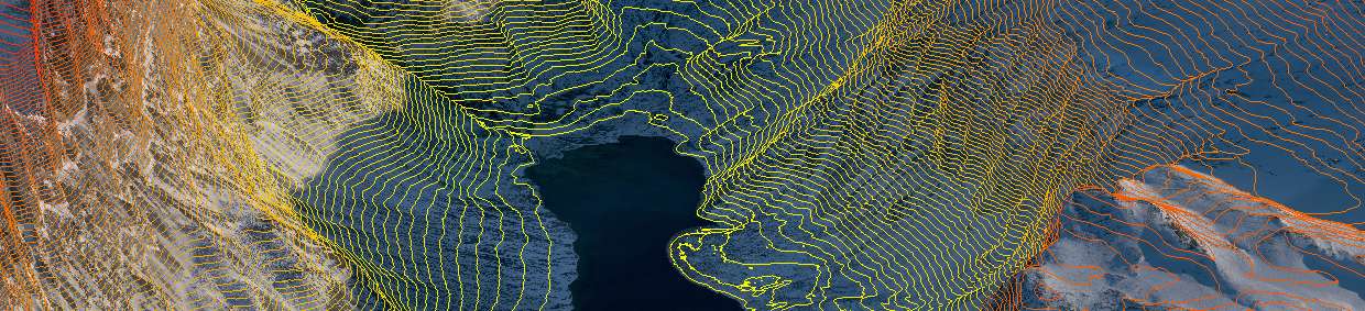
Here at Merrett Survey we have provided mining clients with area-wide lidar to help them in their exploration work. With high accuracy digital terrain models (DTM) generated from our aerial and ground based mine surveying services, clients can map their prospect areas in detail, plot their geological data, merge in existing borehole data, compare the inferred ore body to surface features and to plan the necessary infrastructure such as road and rail access.
Where exploration drilling programmes are planned our mining surveyors can set-out new borehole locations, surveyed and coordinated existing / historic borehole locations, plus stake out the prospect or licenced exploration areas accurately on the ground.
Aerial lidar will ‘see’ through tree cover and we can map the true ground shape (DTM) below forest cover, saving greatly on over ground-based methods. For more information on this please refer to our Lidar Technology page or our Lidar website.
Lidar for mining provides a terrain mapping resource that is not only used for exploration planning, but also the development of infrastructure and planning of the mining operations themselves.
We have carried out a variety of different mining exploration projects over the years, working on every Continent in a range of different countries, including Greenland, UK, Morocco, Liberia, Guinea, Ivory Coast, Sierra Leone. Ask us about our previous experience (in more than 60 countries) today and learn about the results of previous Merrett Mining Survey exploration survey projects.
Please contact our aerial mining survey team for full information and a quotation.
Get In TouchAerial lidar is most often deployed using full sized fixed wing aircraft, but now UAV drone technology can also exploit the advantages of lidar and this is now included in our mining survey services.
Get In TouchMerrett Survey Limited has experience of measuring the accurate location and extents of historical mine workings, in connection with re-opening of workings, or checking their proximity to new developments above and underground. As commodity prices rise and fall, often old workings are re-opened or new developments can be close to old workings, and it’s essential to know their 3D orientation in order to accurately and safely plan the diamond drilling exploration boreholes.
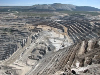
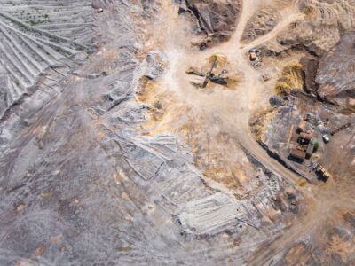
Our work on opencast sites or quarries includes the application of long range laser scanning and mapping from drones.
Get In TouchUnderground mine surveying can be undertaken using ‘traditional’ traversing methods or using the latest hand held mobile mapping laser scanners, known SLAM technology (Simultaneous Localisation and Mapping).
With this innovative rapid handheld technology, we can survey mines simply by walking through the site to create a laser point cloud model of the mine. Our mobile mapping mine surveying technology also allows us to gather data on even very large sites at a survey-grade level of precision.
Surveys like this can be performed before new shafts, raises, or drives are excavated, or prior to the installation of new equipment. Our mining surveyors can survey a tunnel to factor in the space required for the designed equipment, ensuring that it will fit properly, thus avoiding expensive mistakes.
For more information on this please refer to our laser scanning page, or contact our mining surveyors.
Get In TouchThe use of remote sensing methods in our mining surveys is one of our latest areas of development. Surveying using satellite imagery has become more detailed in recent years, ever improving resolution of imagery, and far more accurate than it ever was before. The technology has evolved to the stage where it could potentially function as a replacement for fixed wing aircraft aerial mining surveys.
If you have a new or expanding mining project that needs surveying, a map of the mine site and its surroundings, or a digital terrain model (DTM), then Merrett Survey can offer fixed wing photogrammetry and lidar solutions, and this exciting new, alternative high resolution satellite imagery and mine survey mapping through remote sensing.
The use of low cost mini-satellites for mining surveys is another area we are keeping a close eye on, so be sure to check in on the technologies page of our website to see what new and innovative technology and techniques we are employing in our mining surveys.
Get In TouchWe at Merrett Survey are proudly celebrating 40 years of operation as a mining and topographical surveying business. From our office in South West England, we have expanded to conduct mine surveys and mining exploration projects all over the world.
If you would like to learn more about us or are interested in our mining surveyor services, please contact us for further information or to discuss our mine survey services. If you would like to call us directly, please use the phone numbers on our contact page or email us. One of our professional mine survey team members will be happy to receive your query.
Get In Touch