

UAV Drone Surveys For Open-Pit Mining
The mining industry has witnessed a remarkable shift in how surveying operations are conducted over the past 10-20 years, with UAV (Unmanned Aerial Vehicle) drone technology leading the charge. For open-pit (or open-cast surveys) mining operations worldwide, drone surveys have moved from experimental technology to essential operational tools, delivering unprecedented accuracy, safety improvements and cost efficiency.
The Evolution Of Open-Pit Mining Survey Methods
Traditional ground-based surveying methods, whilst reliable, often required personnel to access potentially hazardous areas and could take days or even weeks to complete comprehensive site surveys. The introduction of UAV technology has fundamentally changed this approach, enabling mining operations to capture detailed topographical data in a fraction of the time whilst keeping personnel safely away from danger zones.
Modern mining drones equipped with advanced sensors can now survey hundreds of hectares in a single day, capturing millions of data points that create highly accurate 3D models of mining sites. This technological leap has particular relevance for opencast mining surveys, where regular monitoring of vast areas is essential for operational planning and safety compliance.
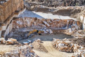
Key Applications Of UAV Drone Surveys in Open-Pit Mining
Stockpile Volume Calculations
One of the most valuable applications of UAV surveys in mining is precise stockpile volume measurement. Drones equipped with photogrammetry sensors or LiDAR technology can calculate material volumes with accuracy levels exceeding 95%, providing mining operations with reliable data for production reporting and inventory management.
Blast Planning and Analysis
UAV surveys enable mining engineers to plan blast patterns with greater precision by providing detailed pre-blast topographical data. Post-blast surveys conducted immediately after detonation allow for rapid assessment of blast effectiveness and fragmentation analysis, supporting continuous improvement in blasting operations.
Haul Road Monitoring
Maintaining safe and efficient haul roads is critical for mining productivity. Regular drone surveys identify surface degradation, drainage issues and gradient changes before they become operational hazards, supporting proactive maintenance scheduling.
Slope Stability Assessment
Perhaps the most critical safety application, UAV surveys provide detailed monitoring of pit wall stability. By comparing successive surveys, geotechnical engineers can identify subtle movements that may indicate potential slope failures, enabling preventative action before dangerous conditions develop.
| Technology | Best Application | Accuracy Level | Weather Dependency | Data Processing Time |
|---|---|---|---|---|
| Photogrammetry | General site mapping, volumetric surveys | ±2-5cm | High (requires good lighting) | Moderate (2-4 hours) |
| Lidar-equipped UAVs | Dense vegetation areas, complex terrain | ±1-3cm | Low (works in varied conditions) | Fast (1-2 hours) |
| Multispectral | Environmental monitoring, vegetation analysis | ±5-10cm | Moderate | Moderate (3-5 hours) |
Regulatory Compliance & Safety Benefits

The adoption of UAV technology in mining surveys directly addresses two fundamental industry concerns: regulatory compliance and personnel safety.
From a safety perspective, drone surveys eliminate the need for surveyors to access active pit areas, unstable slopes or other hazardous zones. This risk reduction is particularly significant for quarry surveys and operations where working faces change daily.
Key safety advantages of UAV surveys include:
- Elimination of personnel exposure to unstable pit walls and active mining areas
- Real-time monitoring without requiring physical site access
- Rapid survey completion reducing time spent in hazardous zones
- Enhanced ability to survey areas following incidents or extreme weather events
- Comprehensive site coverage without blind spots or inaccessible areas
Regulatory compliance has also become more streamlined through UAV adoption. Many jurisdictions now require regular topographical surveys for environmental reporting and rehabilitation monitoring. Drone surveys provide the detailed, timestamped data needed to satisfy these requirements whilst creating comprehensive digital records for audit purposes.
Integration With Existing Mining Systems
Modern UAV survey data integrates seamlessly with mine planning software, allowing engineers to import drone-captured data directly into systems they already use for design and scheduling. This integration capability means that survey data can quickly inform operational decisions without requiring manual data transfer or format conversion.
The data captured through UAV and drone surveys also complements other survey technologies. When combined with terrestrial laser scanning for detailed infrastructure surveys or ground-based measurements for validation, mining operations achieve comprehensive site documentation that supports both daily operations and long-term planning.
Cost-Effectiveness & ROI
Whilst the initial investment in UAV survey technology or outsourcing to specialist providers represents a significant decision, the return on investment typically becomes apparent within months. Survey costs per hectare have decreased dramatically compared to traditional methods, whilst the frequency of surveys can increase without proportional cost increases.
Financial benefits of implementing UAV surveys:
- Reduced labour costs for routine surveying operations
- Lower equipment mobilisation expenses compared to traditional methods
- Increased survey frequency without proportional cost increases
- Faster turnaround times enabling more responsive decision-making
- Reduced downtime in active mining areas during survey operations
- Lower insurance and safety-related costs through reduced personnel exposure
Mining operations can now conduct weekly or even daily surveys of critical areas, providing real-time data that supports agile decision-making. This survey frequency would be prohibitively expensive using traditional ground-based methods but becomes economically viable through UAV technology.
Looking Ahead: The Future Of UAV Mining Surveys
As we progress through 2026, the capabilities of UAV survey technology continue to expand. Automated flight planning, AI-assisted data processing and real-time analysis are becoming standard features rather than cutting-edge innovations. Mining operations that embrace these technologies position themselves advantageously for operational efficiency and safety performance.
For mining operations considering the transition to UAV survey methods, partnering with experienced specialists who understand both the technology and the unique requirements of mining operations ensures successful implementation. Whether for routine operations and development surveys or specialised applications, UAV technology represents the present and future of mining surveying.
Expert UAV Survey Support For Your Mining Operation
At Mining Surveys, we’ve been providing specialist mining survey services for over 40 years, working with operations across six continents. Our team combines extensive mining industry knowledge with cutting-edge UAV technology to deliver surveys that support your operational and planning objectives.
Whether you’re looking to implement UAV surveys for the first time or enhance your existing surveying capabilities, our experienced team can guide you through the process and deliver the accurate, actionable data your operation needs. Call us on +44 (0)1392 362161 or email info@merrettsurvey.com.
Looking Ahead: The Future Of UAV Mining Surveys
As we progress through 2026, the capabilities of UAV survey technology continue to expand. Automated flight planning, AI-assisted data processing and real-time analysis are becoming standard features rather than cutting-edge innovations. Mining operations that embrace these technologies position themselves advantageously for operational efficiency and safety performance.
For mining operations considering the transition to UAV survey methods, partnering with experienced specialists who understand both the technology and the unique requirements of mining operations ensures successful implementation. Whether for routine operations and development surveys or specialised applications, UAV technology represents the present and future of mining surveying.
Expert UAV Survey Support For Your Mining Operation
At Mining Surveys, we’ve been providing specialist mining survey services for over 40 years, working with operations across six continents. Our team combines extensive mining industry knowledge with cutting-edge UAV technology to deliver surveys that support your operational and planning objectives.
Read More About UAV surveying in the mining industry
- The benefits of UAV surveying within the mining industry
- Innovations in Mobile Mapping for mining surveys
- Underground Laser Scanning for surveying
Whether you’re looking to implement UAV surveys for the first time or enhance your existing surveying capabilities, our experienced team can guide you through the process and deliver the accurate, actionable data your operation needs. Call us on +44 (0)1392 362161 or email info@merrettsurvey.com.